The FAQs are AI-generated, and Fortune India is not responsible for its content or any associated copyright issues.
IMD forecasts thunderstorms, sharp temperature drop amid North India heatwave
/ 2 min read
The national weather agency said maximum temperatures across northwest India could decline by 6-8 degrees Celsius by Saturday, offering significant relief from the intense heat that gripped the region for most of May
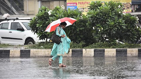
IMD will issue the updated forecasts for monsoon season rainfall in the last week of May. | Credits: Getty Images
Large parts of north India are likely to witness a sharp fall in temperatures over the next few days after prolonged heatwave conditions, with the India Meteorological Department (IMD) forecasting widespread thunderstorms, rain and strong winds across several states through the weekend.
The weather office said maximum temperatures across northwest India could decline by 6-8 degrees Celsius by Saturday, offering significant relief from the intense heat that gripped the region for most of May.
Delhi-NCR gets relief after intense heat
Delhi and several National Capital Region (NCR) cities received heavy rain, dust storms and gusty winds on Thursday evening, bringing immediate respite from scorching temperatures and high humidity levels.
Several parts of the national capital witnessed moderate to heavy showers, while strong winds and dust storms disrupted traffic movement in Noida, Ghaziabad, Gurugram and Faridabad. Reduced visibility during peak evening hours led to slow-moving traffic and congestion across key stretches in NCR.
The sudden change in weather followed an extremely hot day in Delhi, where residents faced harsh sunlight and hot winds through the afternoon. By evening, dark clouds covered the city, followed by rainfall that led to a noticeable drop in temperatures.
According to the IMD, temperatures in Delhi-NCR are expected to fall by around 5-7 degrees Celsius after May 29. Maximum temperatures in the capital are likely to remain between 34 degrees Celsius and 37 degrees Celsius over the coming days, significantly below the highs recorded earlier this week.
The IMD has forecast thunderstorms accompanied by lightning and strong winds over Delhi on Friday and during the weekend. Similar weather conditions are expected across Punjab, Haryana, Uttar Pradesh and Rajasthan.
Western disturbance behind weather shift
Meteorologists said the weather shift has been triggered by a combination of systems, including an active western disturbance over the Himalayan region, an induced cyclonic circulation over Rajasthan and adjoining areas, and moisture-bearing winds from the Bay of Bengal that have increased atmospheric instability across north and central India.
Satellite imagery from INSAT-3DS on Friday showed a massive cloud band stretching across north, central and eastern India, indicating widespread thunderstorm activity across multiple regions.
The IMD has also warned of hailstorm activity over Himachal Pradesh, Uttarakhand, Punjab, Haryana, Delhi and Uttar Pradesh, while dust storm conditions are likely to continue in isolated parts of Rajasthan and Uttar Pradesh.
In eastern India, Bihar, Jharkhand, Odisha and West Bengal are expected to receive thunderstorms and isolated heavy rainfall. The northeast region is likely to remain under a prolonged wet spell, with heavy rainfall forecast across Assam, Meghalaya and Arunachal Pradesh over the next few days.
RANK
COMPANY NAME
REVENUE
(INR CR)
(INR CR)
{{#current-rank}} {{current-rank}} {{/current-rank}} {{^current-rank}} {{rank}} {{/current-rank}} {{name}} {{#revenue}} {{revenue}} {{/revenue}} {{^revenue}} {{noi}} {{/revenue}}
Southern states including Karnataka, Kerala, Tamil Nadu, Telangana and Andhra Pradesh are also expected to witness widespread rainfall activity accompanied by thunderstorms and gusty winds.
While heatwave conditions are likely to ease across most parts of northwest and central India, the IMD said isolated pockets of Rajasthan, Madhya Pradesh, Vidarbha, Telangana and Andhra Pradesh may continue to experience high temperatures.
Meanwhile, the southwest monsoon is expected to reach Kerala by or before June 3, while its arrival over Delhi is currently projected around June 27.
Frequently Asked Questions
NEXT STORY